If you hear this days about drones, you will automatically think of military. And yet this exciting progressive technology can be very useful. We thought about, how we can make this drone technology useful to help after natural disasters.
Nowadays after a natural disaster and after the aides arrived it takes several days until new maps from satellites are available to them and they can begin with their operation. This enormous waiting time we want to overcome with the technology of autonomous flying drones which are collecting data for new maps.
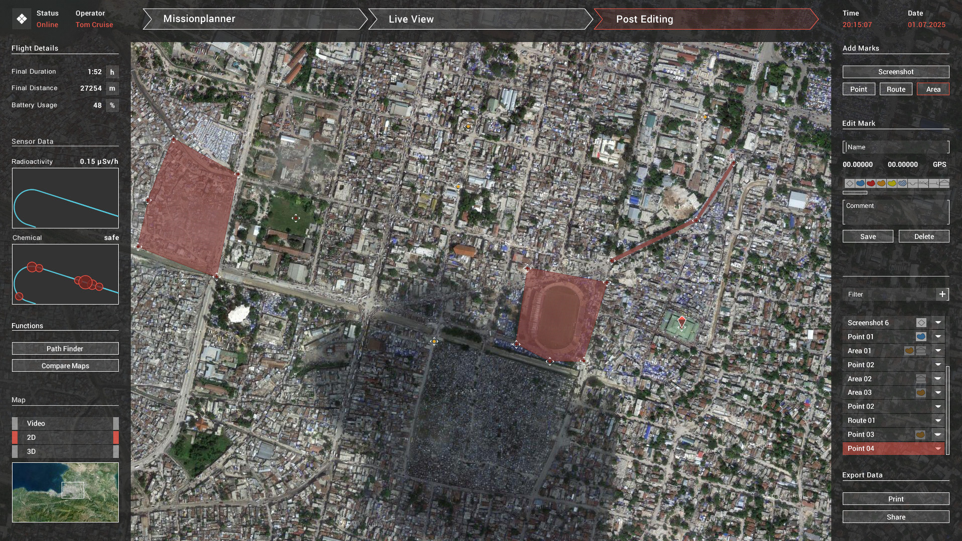
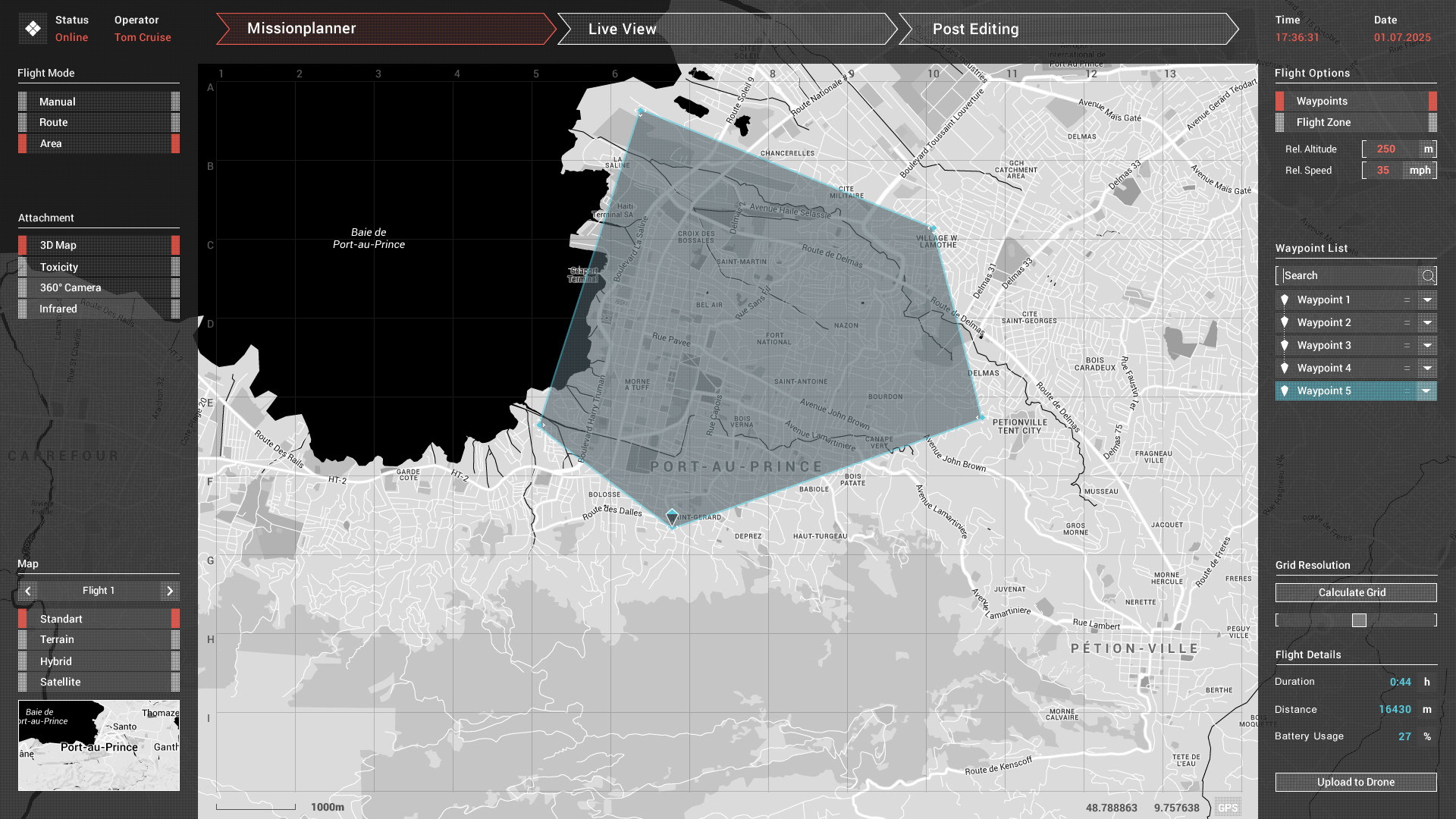
The route coordinates, that should be flown by the drone, will transmitted by GPS, thereby the drone can fly autonomous the chosen route. During the flight the drone takes pictures continuously in birds view. These pictures will be processed to a 3D map. Afterwards the 3D map can be processed into a 2D map and then printed out for a fast use by the relief forces.
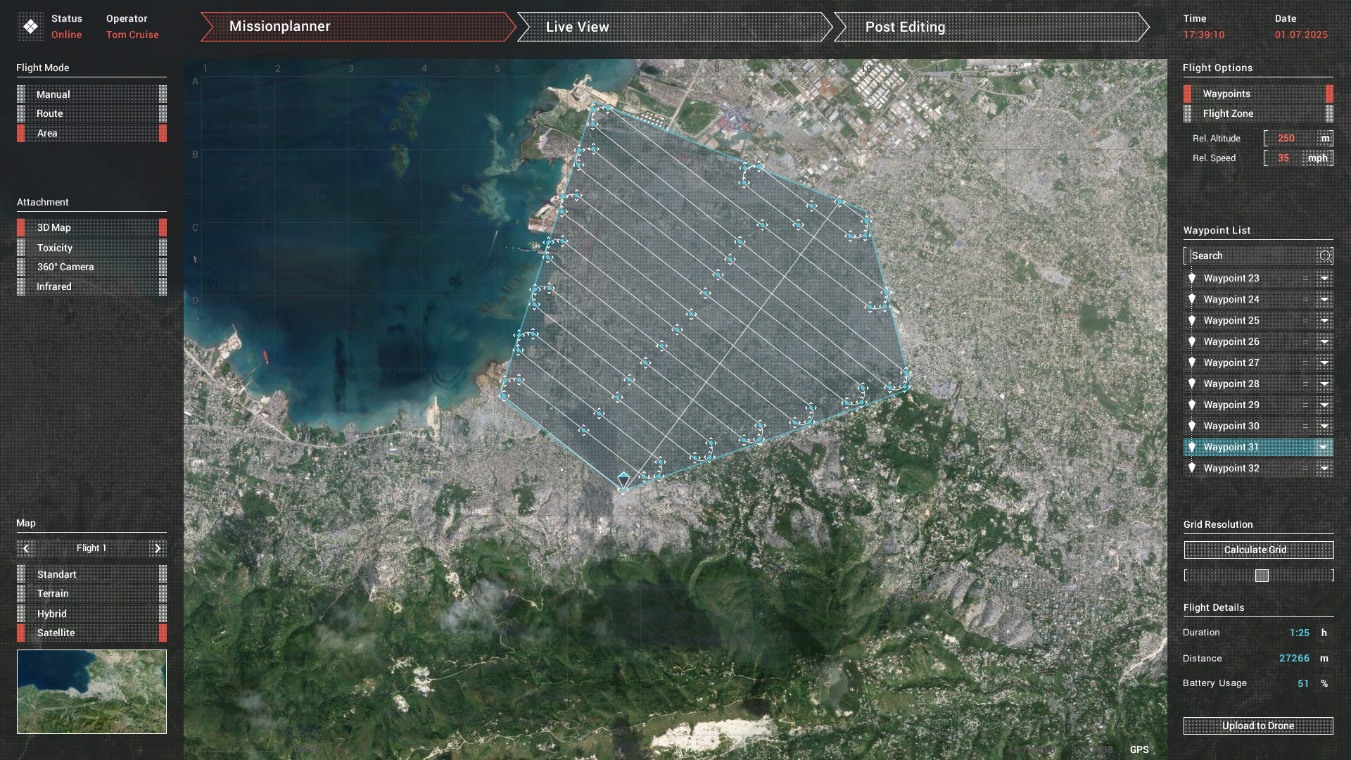
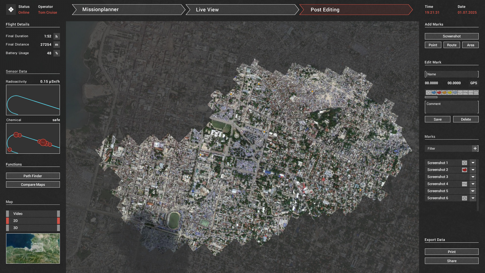
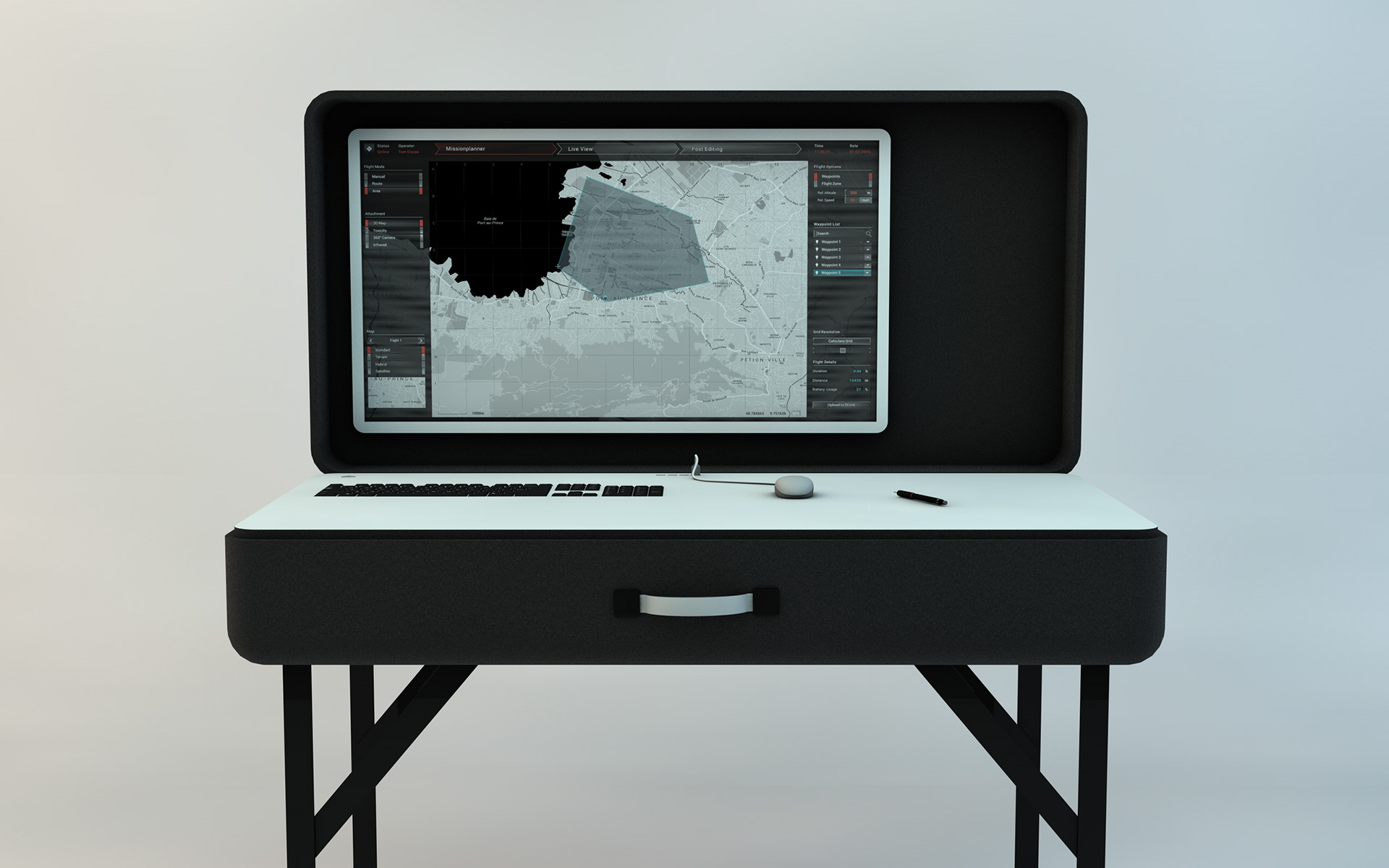
The application that we designed enables this tasks. With it you can plan the autonomous drone flight and transmit them to the drone (Mission Planer), watching the flight by lifestream (Live View) and visualize the captured map material after the flight (Post Editing). For that process, the system takes only a few hours. After that the relief forces are able to begin with their rescue missions immediately
Drone Mapping System is my Bachelor Thesis, in collaboration with Johannes Preibisch and Laurens Rinke, from the University of Applied Sciences Schwäbisch Gmünd. It also features a written Thesis, which can be asked for via E-Mail: beehmathias@gmail.com